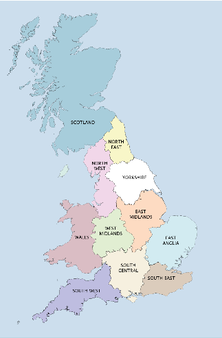
Click on a region to select - North West and Yorkshire are active, North East due in 2019
Contains OS data © Crown copyright and database right (2017)



You are free to reproduce any of the text of this work for non-commercial purposes only, provided proper attribution, credit and citation is given to the author, any original contributor or source, and the RRRA. Where photographs and diagrams carry additional copyright details, this Creative Commons license does not apply.

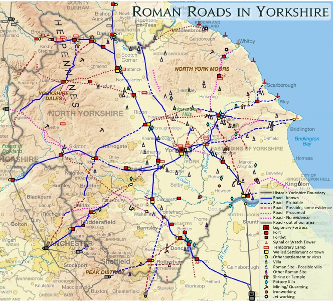
Roman Roads in Yorkshire.
The map above is interactive - simply click on any road to bring up a detailed and illustrated summary. Hovering over military sites and settlements (the red and yellow icons) will also bring up their labels. Alternatively, scroll down this page for a list of all the known and probable Roman roads in Yorkshire - each road name is clickable and will bring up it’s gazetteer entry. With a county of such a size, it is no surprise that there are 51 entries , although we have also included RR2d and RR28aa in Lincolnshire, roads whose sole function was to access the territories of the Parisi and the Brigantes, the two late Iron Age tribal territories that make up modern Yorkshire.
The numbering system used is that originally developed by Ivan Margary in the mid 20th century, which provides a consistent form of identification. To accommodate roads identified after Margary’s death in 1976, we have continued to use his system but have added an (x) suffix. Numbers bearing the prefix RRX were awarded by the Ordnance Survey’s Archaeological Division who (for reasons best known to themselves) did not follow Margary’s logical numbering system: wherever such roads have been proven to be of Roman origin they have now been awarded numbers using Margary’s original system with the (x) suffix.
To give some historical background to this work, there is an overview of the work of the many antiquaries and researchers who have made contributions to our understanding of the Roman road network in Yorkshire over the last five decades, and this can be accessed via the “Previous Research in Yorkshire” button above.
All entries are the work of Mike Haken, although many thanks are due to Jayne Knight for editing the draft text, a not inconsiderable task. I must also thank some of the many individuals who have contributed, assisted and advised over the many years it has taken to compile these entries, in particular the late Hugh Toller, David Ratledge, Bryn Gethin, Pete Wilson, John Poulter, Olly Cooper, and the staff at Yorkshire’s many HERs.

Possible Roman Road from Bainbridge to Healam Bridge
Contains OS data © Crown copyright and database right (2017)


Roman Road
Bainbridge to Mallerstang

Verteris
Brough Fort and Vicus

Johnson’s Plain Signal Tower

Roper Castle Signal Tower

Bowes Moor Temporary Camp

Greta Bridge Fort & Vicus
Piercebridge Pottery Kiln

Carkin Moor (E. Layton) Fort

Virosidvm
Bainbridge Fort & Vicus

Roman Road 731 between Sedbergh & Kirkby Stephen

Possible Roman Road from Bainbridge to Catterick

Traditional but doubtful route of M2e between Barmby on the Moor and York

Flamborough Head Signal Station

Scarborough Signal Station

Whitby Possible Signal Station

Cawthorn Fort
& Camps Complex

Roman Road 81b
Wades Causeway

Roman Road from Malton to Filey 816

Buttercrambe Moor Temporary Camp

Possible Roman Road southwards from Bawtry

Petvaria
Brough on Humber
Fort & Civitas Capital

Derventio
Stamford Bridge Fort(?) & Settlement

Bootham Stray Temporary Camps

Huntington Temporary Camps

Rossington Bridge Vexillation Fortress

Ebvracvm
York Legionary Fortress
& Colonia

Calcaria
Tadcaster Settlement

Danvm
Doncaster Fort & Vicus

Templeborough Fort & Vicus
Lagentivm
Castleford Fort & Settlement

Newton Kyme Fort,
Vicus & Temporary Camps

Ribchester Fort & Settlement
Isurivm Brigantvm
Aldborough, Civitas Capital

Cataractonivm
Catterick Fort, Town & Camp

Breckenbrough Temporary Camp
Stanwick
Brigantian Oppidum

Piercebridge Fort
Vicus, Bridge, Settlement

Vinovivm
Binchester Fort & Vicus

Mastiles Lane Temporary Camp

Lavatris
Bowes Fort & Vicus

Healam Bridge Fort & Vicus

Leeds, Possible Settlement
Goldsborough Signal Station
Historical Background
Contains Ordnance Survey data
© Crown copyright and database right 2010
additional features © RRRA 2018
Introduction & List of Roads